 Syken metatietopalvelu
LuTU2018 Tunturiluontotyyppien esiintymäaineistot uhanalaisuusarvioinnissa, Metsähallitus
LuTU2018 Tunturiluontotyyppien esiintymäaineistot uhanalaisuusarvioinnissa, Metsähallitus
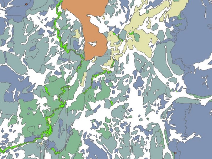
Luontotyyppien uhanalaisuusarviointia (LuTU) 2018 varten koottiin esiintymäaineistoja yhteensä yli 150 luontotyypistä tai luontotyyppiyhdistelmästä. Aineisto on jaettu tiedostoihin luontotyyppien pääryhmien mukaan.
Kaikki tunturiluontotyyppien tunnetut esiintymät ovat tässä aineistossa: -Aluemaiset aineistot ovat tunturialueelta Metsähallituksen SAKTI-kuviotietojärjestelmästä. -Pistemäiset aineistot täydentävät edellistä aineistoa niillä tunturialueilla, joista SAKTI-kuviotietojärjestelmässä ei ole tietoja.
Aluemaiset ja pistemäiset aineistot muodostavat yhdessä pääosan tunturiluontotyyppien julkaistujen 10 km x 10 km -ruutukarttojen tausta-aineistosta. Aineistosta puuttuvat ruutukartoille asiantuntija-arvioina lisätyt esiintymät, joista ei ole ollut käytettävissä tarkkaa paikkatietoa. Luokitukset ovat tarkemmin erillisessä liitedokumentissa https://geoportal.ymparisto.fi/meta/julkinen/dokumentit/TunturiluontotyyppienEsiintymäaineistotUhanalaisuusarvioinnissa2018.pdf
Lisätietoja Suomen luontotyyppien uhanalaisuusarviosta
https://luontotyyppienuhanalaisuus.ymparisto.fi/lutu/#/
https://helda.helsinki.fi/items/3cb6905b-0e6e-40e2-9499-e7e4a91ed1a2
https://helda.helsinki.fi/items/10514c25-bd64-429c-a057-63bf37f3e709
Täydennykset puuttuvista tunturikoivulehdoista, lapinvuokkokankaista, tunturiniityistä sekä kalkki-, serpentiini- ja kiisukallioista voi lähettää kuvauksineen tulevaa uhanalaisuusarviointia varten osoitteeseen luontotyyppienuhanalaisuus@syke.fi.
Aineiston on tuottanut Metsähallitus.
Aineistoa voi käyttää uhanalaisuusarvioinnin lisäksi erilaissa selvityksissä ja ympäristöhallinnon tehtävien tukena.
Aineisto kuuluu SYKEn avoimiin aineistoihin (CC BY 4.0)
RLE Finland 2018 Fell habitats in the assessment of threatened habitat types, occurrences
The dataset was used in the threat assessments of Finnish habitat types 2018. The collected dataset includes 150 habitat types and is divided into different files according to the main divisions of the habitat types. This data contains the occurrences of the fell habitats. The data was produced by Metsähallitus and processed in Syke.
This dataset contains all known occurrences of fell habitat types. The data consists of polygon and point datasets. The polygons come from SAKTI Protected area compartment information system in Metsähallitus. The point dataset complements the polygons for habitat types which are not included in the SAKTI data.
The polygon and point datasets have been the main source for the published 10 km x 10 km grid maps on fell habitat types. The dataset is missing the coarse observational data based on expert knowledge on fell habitat types included in the grid maps, as the observational data do not have accurate location.
The full classification of habitat types can be found on a separate excel file: https://geoportal.ymparisto.fi/meta/julkinen/dokumentit/habitat_type_list.xls
More information on habitat type threat assessment
http://urn.fi/URN:ISBN:978-952-11-5110-1
This dataset was produced by Metsähallitus.
In addition to threat status assessment this dataset can be used for research and to support the tasks of the environmental administration.
This dataset of Syke can be used according to open data license (CC BY 4.0)
Simple
Identification info
- Title
-
LuTU2018 Tunturiluontotyyppien esiintymäaineistot uhanalaisuusarvioinnissa, Metsähallitus
- Date (Publication)
- 2022-05-03
- Point of contact
-
Organisation name Electronic mail address Role Suomen ympäristökeskus
Point of contact
-
SYKE resource classification
-
-
Paikkatietoaineisto
-
- Keywords
-
-
Ei-Inspire
-
tunturiluontotyypit
-
luontotyypit
-
uhanalaiset luontotyypit
-
luontotyyppien uhanalaisuus
-
Red List of Ecosystem
-
threatened habitat types
-
tunturit
-
fells
-
FEO
-
Resource constraints
- Use constraints
- Other restrictions
- Other constraints
-
Creative Commons Nimeä 4.0 Kansainvälinen https://www.syke.fi/fi/ymparistotieto/kayttolupa-ja-vastuut
Lähde: Metsähallitus ja Syke
This dataset of Syke can be used according to open data license (CC BY 4.0)
- Access constraints
- Other restrictions
- Other constraints
- no limitations
- Spatial representation type
- Vector
- Denominator
- 10000
- Metadata language
- English
- Topic category
-
- Biota
- Environment
Temporal extent
Spatial extent information
))
- Unique resource identifier
- EPSG:3067
- Codespace
-
EPSG
- Distribution format
-
- ESRI Shape ( -)
Digital transfer options
- OnLine resource
-
Protocol Linkage Name https://wwwd3.ymparisto.fi/d3/gis_data/spesific/LuTU2018_tunturiluontotyypit.zip Syken Avoin tieto -palvelu: Tunturiluontotyyppien esiintymäaineistot uhanalaisuusarvioinnissa 2018, Metsähallitus
- Hierarchy level
- Dataset
- Statement
-
Aluemaiset tunturiluontotyyppiaineistot ovat pääasiassa Metsähallituksen SAKTI-kuviotietojärjestelmästä irrotettua kuviotietoa. Haut on tehty Metsähallituksessa tammi–helmikuussa 2017, poikkeuksena tunturikoivulehdot, jotka on haettu 18.9.2017. Muut poikkeukset: -Aineistot variksenmarjatunturikoivikoista (T01.02.01), liekovarpiokankaista (T04.07), ravinteisista kangasmaisista lumenviipymistä (T07.01.02.01), ravinteisista sammalvaltaisista lumenviipymistä (T07.01.02.03), lumenpysymistä (T07.02) ja rotkolaaksoista (T12.01) puuttuvat, sillä niistä on olemassa vain karkeaa asiantuntijatietoa.
Pistemäiset tunturiluontotyyppiaineistot on koottu eri lähteistä, kuten asiantuntijahavainnoista, Geologian tutkimuskeskuksen aineistoista sekä Laji-GIS-järjestelmästä.
Aineiston sijainti tietokannassa ..\gis\data\luonto\LuTU2018Esiintymat.gdb -LuTU2018_tunturiluontotyypit_alue -LuTU2018_tunturiluontotyypit_piste
Aineistot ovat alkuperäismuodossa, eikä niiden geometriaa ole korjattu.
The majority of the polygon fell habitat type dataset was extracted from SAKTI Protected area compartment information system by Metsähallitus. The data was retrieved from Metsähallitus in January and February 2017, except for data on herb-rich mountain birch forests, which was retrieved on 18.9.2017. Other exceptions: The following habitat types Empetrum mountain birch forests (T01.02.01), Cassiope tetragona mountain heaths (T04.07), eutrophic heathlike snowbeds (T07.01.02.01), eutrophic bryophyte-rich snowbeds (T07.01.02.03), snow patches (T07.02), and canyons (T12.01) are missing data, because only coarse observational data based on expert knowledge is available for them.
The point dataset of fell habitat types was compiled from various sources. These included unpublished expert knowledge, data from the Geological Survey of Finland and from the the national species information database LajiGIS.
The datasets are in their original formats and without any geometry corrections.
Metadata
- File identifier
- {893F71DE-5333-4528-8778-71B7FC0FD70B} XML
- Metadata language
- Finnish
- Character set
- UTF8
- Hierarchy level
- Dataset
- Date stamp
- 2026-10-01
- Metadata standard name
-
ISO19115
- Metadata standard version
-
2003/Cor.1:2006
- Metadata author
-
Organisation name Electronic mail address Role Suomen ympäristökeskus
Point of contact
)))
